MRV in practice: how methodology, data and assurance shape carbon outcomes
ICBA · 22 Sept 2026
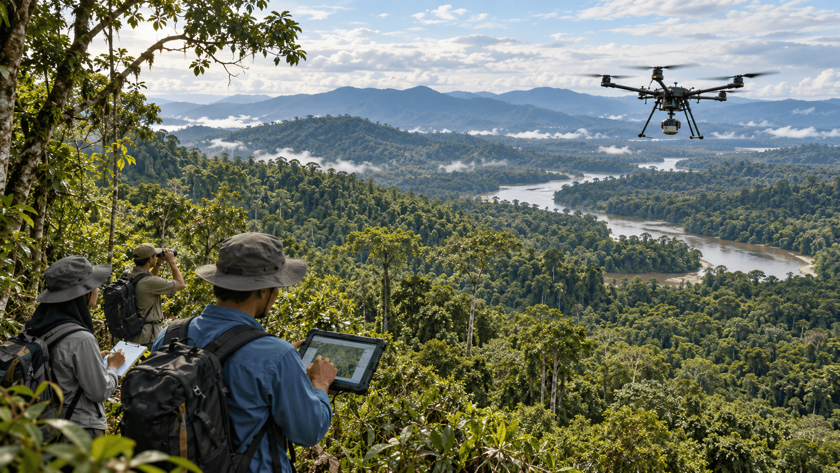
The unit is common. The evidence is not.
Carbon markets reduce complex environmental outcomes to a common unit of account: a tonne of carbon dioxide equivalent. The apparent simplicity of that unit obscures how differently the underlying outcome may have been established.
A tonne generated through avoided peatland conversion is not measured in the same way as a tonne accumulated through mangrove restoration, and neither resembles the evidence system behind an engineered removal. Each may produce the same unit, but the route to it — the baseline, monitored variables, models, sampling design, treatment of uncertainty and independent assurance — can be materially different.
This is the practical role of measurement, reporting and verification. MRV is sometimes discussed as though it were a technical function applied after a project has been designed. It is better understood as an assurance architecture running through the project itself: methodology determines what must be demonstrated, measurement produces the evidence, reporting makes that evidence traceable and reproducible, and independent verification tests whether the resulting claim has been established in accordance with the applicable rules. The robustness of a quantified carbon outcome depends on the strength of the entire chain.
MRV begins with methodology, not measurement
MRV does not begin when a field team takes a measurement or a satellite image is downloaded. It begins with the methodology, which determines the accounting problem the project is required to solve: the project boundary, relevant greenhouse-gas sources and carbon pools, baseline approach, monitored parameters, permitted measurement techniques, treatment of leakage, calculation procedures and rules for managing uncertainty.
This matters because carbon accounting combines variables that can be observed directly with outcomes that must be inferred. Tree diameter can be measured. Forest cover can be observed. Peat water levels can be monitored. The carbon consequence of those observations, however, is established through equations, models and methodological assumptions. The methodology provides the bridge between the physical evidence and the quantified outcome.
It is also why apparently similar projects produce different MRV requirements. In afforestation or reforestation, the accounting question may centre on how much biomass has accumulated over a monitoring period. In avoided deforestation, the central question is how observed forest conditions compare with a counterfactual scenario of what would likely have happened without the intervention. Peatland projects add hydrological conditions and emissions associated with drainage and degradation. Engineered systems may depend far more heavily on direct metering and process data.
The baseline is one of the most consequential design choices
A baseline is not simply a historical number. It represents the scenario against which project performance will be quantified, and for many project types it requires a judgement about what would have happened in the absence of the project.
For an avoidance project, some of the most important emissions are precisely those that did not occur. They cannot be observed directly. Instead, the project monitors what actually happened and compares that outcome with a methodology-defined counterfactual — which introduces a fundamental distinction between observed evidence and modelled outcomes.
Neither is inherently problematic; carbon accounting frequently requires both. But they should not be confused. A satellite may provide strong evidence that forest cover remained intact during a monitoring period. It does not, by itself, establish the rate of deforestation that would have occurred without the project. That requires a baseline model and the assumptions permitted by the methodology. The quality of MRV therefore depends not only on the accuracy of field instruments or satellite data, but on the credibility of the framework into which those observations are placed.
This is particularly significant for nature-based projects, where counterfactuals, ecological variability and long time horizons can introduce greater methodological complexity than systems based predominantly on direct industrial measurement. It is also why some methodologies require baselines to be reassessed or updated over time rather than treated as permanently fixed at registration.
Building the evidence base
Once the methodological framework is established, MRV becomes a question of evidence design. The objective is not to collect the greatest possible volume of data. It is to collect the right data, at sufficient quality and representativeness, in a form that supports the methodology and can withstand independent review.
For large nature-based projects, this normally requires a combination of evidence sources. Field plots provide direct measurements of biomass at specific locations; tree diameter, height and species information are converted into biomass estimates using allometric equations. These measurements can be highly informative, but they cover only a sample of a much larger landscape.
Remote sensing provides scale. Optical imagery, radar and LiDAR support different aspects of forest monitoring, structural measurement and change detection, and each carries practical limitations in tropical environments: persistent cloud affects optical imagery, radar performance can be constrained in very high-biomass forest, and LiDAR offers detailed structural information at greater cost. The strongest systems therefore do not choose between field data and remote sensing. They combine them, using ground observations to calibrate and validate remotely sensed estimates while remote sensing extends observation across areas that would be impractical to measure directly. In heterogeneous Indonesian landscapes, that relationship between ground truth and landscape-scale observation is particularly important.
The same principle applies beyond forests. Peatland projects may rely on hydrological measurements alongside land-cover monitoring. Mangrove restoration requires permanent sample plots, tree-growth measurements and biomass equations. Soil-carbon projects introduce sampling depth, bulk density, laboratory analysis and temporal variability. Engineered systems rely more heavily on calibrated meters, flow data and storage records. Across these examples, the central issue is not the technology itself. It is whether the evidence system is sufficiently representative, calibrated, documented and consistent with the methodology.
Sampling, uncertainty and credited volume
Carbon accounting often operates at scales where complete measurement is impossible. Sampling is therefore not a compromise at the edge of MRV; it is a core part of the system. A project measuring biomass across tens or hundreds of thousands of hectares will typically rely on a representative sample and statistical inference rather than direct measurement of every tree or every hectare. The design of that sample — its size, distribution, stratification and statistical confidence — determines the precision of the resulting estimate.
Uncertainty is sometimes treated as though it represented weakness in a carbon project. In reality, any credible measurement system should identify and quantify uncertainty rather than conceal it. The important question is how the methodology manages it, and the usual answer is a conservative adjustment designed to reduce the risk that an imprecise estimate results in over-crediting.
Programmes and methodologies set different thresholds and treatment rules for uncertainty, but the underlying logic is consistent: where uncertainty is material, the credited outcome may be adjusted conservatively to reduce the risk of over-crediting.
The practical consequence is significant. Measurement design affects more than the technical elegance of a monitoring system. Where conservative deductions are linked to uncertainty, stronger sampling, better calibration and more robust data help protect credited volume. That does not mean every additional measurement automatically creates more credits, nor that all methodologies treat uncertainty in the same way. It means that measurement quality has a direct relationship with the quantity a project is able to substantiate. MRV is therefore both an assurance question and, within the rules of the applicable methodology, a project-design and commercial one.
Reporting is where measurement becomes reproducible
High-quality measurement has limited assurance value if the evidence cannot be followed from source to claim. The monitoring plan establishes what will be measured, how frequently, according to which procedures and with what quality controls. Data-management systems then need to preserve the relationship between raw observations, adjustments, calculations, model outputs and the final reported quantity.
The critical discipline is reproducibility. An independent reviewer should be able to move backwards from the claimed outcome through the calculation chain and understand how that number was produced. This requires more than a well-written monitoring report; it requires an audit trail. Field measurements need to be traceable to locations and monitoring periods. Data transformations need to be documented. Model versions and assumptions need to be identifiable. Corrections need to be controlled. Quality-assurance procedures need to be visible.
As MRV becomes increasingly digital, this auditability becomes more important, not less. Automated data capture, remote sensing and modelling improve monitoring efficiency and coverage, but they also create more complex data chains. A sophisticated model whose inputs, calibration and transformations cannot be independently interrogated does not provide stronger assurance than a simpler system with a complete evidence trail. The relevant question is not whether an MRV system is technologically advanced. It is whether its evidence can be reproduced and independently tested.
Two measurement problems, one unit
Indonesia provides a useful illustration of how differently MRV can operate across nature-based projects.
Avoided emissions across a peat landscape
The Katingan Peatland Restoration and Conservation Project in Central Kalimantan operates across a large tropical peat-swamp landscape. Its MRV architecture combines several forms of evidence. Remote sensing monitors forest-cover change. Hydrological monitoring provides information on peat conditions, which are material because drainage can drive significant emissions and increase fire risk. Leakage monitoring extends attention beyond the immediate project boundary. These observed conditions sit alongside the project’s methodological baseline for estimating what would have occurred without the intervention. The measurement challenge is therefore multidimensional: maintaining evidence of actual landscape conditions while quantifying performance against a counterfactual emissions trajectory.
Biomass accumulation on degraded coastal land
A mangrove restoration project presents a different problem. Here the accounting framework is more directly linked to biomass accumulation on degraded coastal land. Permanent sample plots, tree diameter, height, survival rates and methodology-approved allometric equations provide the basis for estimating carbon accumulated through restoration. The project still requires a baseline, a monitoring system and independent assessment, but the evidence question is different: rather than principally estimating emissions that were avoided, the monitoring system observes and quantifies biological growth over time.
This second case is presented as a project archetype rather than a named project. The measurement problem, not the proponent, is the point.
The value of the comparison is not to rank avoidance against removals. It is to show why MRV cannot be treated as a standardised measurement exercise. Different project types require different combinations of observed data, modelling, field evidence and methodological judgement.
What independent verification assures — and what it does not
Independent verification is the formal assurance stage in this evidence chain. A validation and verification body reviews the monitoring report, underlying datasets, calculations and methodology application. Depending on the project and programme, the process may include site visits, independent sampling, ground-truthing, interviews, document review and corrective action requests where the evidence is incomplete or inconsistent.
This is an important discipline, but its role should be understood precisely. Verification is not normally an independent reconstruction of every tonne from first principles. The verifier does not recreate the entire monitoring programme or generate a new project dataset. It assesses whether the developer’s evidence and calculations conform to the applicable methodology and whether the quantified outcome is sufficiently supported.
The distinction matters. Third-party verification substantially strengthens assurance, because the project’s claim is no longer accepted solely on the developer’s own assessment. But verification remains bounded by the methodology, the available evidence, sampling approaches and professional judgement. It can test whether a project has applied the approved rules correctly. It cannot make a weak methodology strong simply by auditing it rigorously.
Nor should successful verification be interpreted as a complete judgement on project integrity. Additionality, permanence, safeguards, community consent, governance and appropriate market claims all extend beyond MRV. A project with technically sound MRV can still face substantive challenges on social or governance grounds, and a verification statement should not be read as covering questions it was never designed to answer. MRV is one of the foundations of integrity. It is not a substitute for the wider integrity framework.
Indonesia’s framework: what changed, and what did not
Indonesia’s carbon-market architecture changed materially during 2025 and 2026. The national framework now separates broader climate-action tracking from the registry functions used to record tradable carbon units, while formal recognition arrangements connect Indonesian projects with international standards. For MRV, the important point is administrative rather than scientific: the route from verified outcome to issued unit has changed, but the evidence requirements that make the outcome credible have not.
A baseline still needs to be defensible. Monitoring still needs to generate relevant evidence. Data still needs to be traceable. Uncertainty still needs to be managed. Verification still needs to provide independent assurance. Registry architecture can evolve; those technical principles are more durable.
From measurement system to assurance architecture
The most useful way to think about MRV is not as three administrative stages attached to a carbon project, but as a connected chain:
Methodology defines the accounting problem.
Evidence design determines what can be observed and what must be inferred.
Monitoring produces the data.
Reporting creates the audit trail.
Verification tests the claim against the applicable rules.
The applicable programme and registry determine what can ultimately be issued.
Weakness at any point affects the confidence that can reasonably be placed in the final number.
The presence of satellite imagery, field plots, accredited verification or a sophisticated monitoring platform says relatively little in isolation. What matters is how those elements work together, under the methodology, to produce a quantified outcome that is transparent, reproducible and capable of independent assurance. That is where robust MRV is ultimately won or lost.
Key sources
Verra, VCS Standard and VCS Program Guide — methodology, uncertainty and conservativeness. Verra
IPCC, Good Practice Guidance and Uncertainty Management in National Greenhouse Gas Inventories. IPCC
Government of Indonesia, Presidential Regulation No. 110 of 2025 — national carbon economic value framework. BPK
Ministry of Environment / BPLH, Sistem Registri Unit Karbon (SRUK) launch and registry modernisation. KemenLH/BPLH
Verra Registry, Katingan Peatland Restoration and Conservation Project — project description, monitoring and verification documentation. Verra Registry
- Remote Sensing
- Baselines
- Verification